General Information
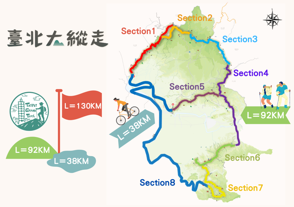
This is a hiking route around the entire Taipei basin. The hike is 92km, and adding in a cycling section, it mounts up to 130km of total distance.
It covers Taipei’s five main mountain ranges: 大屯山、七星山、五指山、南港山、二格山.
This trail passes by some notable locations: 陽明山國家公園、竹子湖、白石湖、圓山、四獸山、貓空.
It provides the opportunity for activities such as: 泡溫泉、賞花、賞蝶、賞芒、品茗、嚐草莓、賞鳥.
The Geotechnical Engineering Office, Public Works Department of the Taipei City Government (臺北市大地處) started designing these trails in 2018. This combines the previous 臺北南縱走(69km) and 臺北南縱走(23km) into a combined trail with seven sections. In 2021, an 8th biking section was added to make it a complete loop around Taipei.
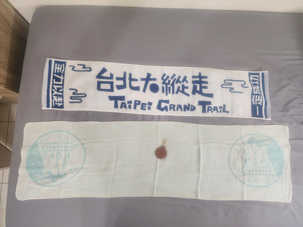
Since 2018, there has been an annual certification event, where if you complete all sections, you can get a certificate, a towel, and other prizes. To complete it, you either us the “Hiking Note app” or take pictures with all 16 of the gem signboards along the trail.
Links to Individual Sections
| Route | Route | Trail Distance | Trail Time |
|---|---|---|---|
| Section1 | MRT Guandu Station → Mt. Zhongyi Trail Entrance (Maple and White Dew/Fontainebleu) → Guizikeng Woodblock Rubbing Pavilion → Qingtian Temple → Miantianping Pavilion → Erzihping Visitor Center | Approximately13 km | 7~8 hours |
| Section2 | Erzihping Visitor Center → Miantianping Pavilion → Mt. Datun West Peak → Mt. Datun South Peak → Mt. Datun Viewing Platform → Xiaoyoukeng Visitor Center | Approximately 12 km (Cumulative 25 km) | 6~7 hours |
| Section3 | Xiaoyoukeng Visitor Center → Mt. Qixing Main Peak → Mt. Qixing East Peak → Lengshuikeng Visitor Center → Qingtiangang Visitor Center → Fengguizui | Approximately 13 km (Cumulative 38 km) | 7~8 hours |
| Section4 | Fengguizui → Shuangxigou Ancient Trail Entrance (Wanxi Mountain Area Road) → Bishan Road → Yuanjue Temple → Yuanjue Waterfall → Dagouxi Water Conservancy Park → MRT Dahu Park Station → (Take bus 620 or walk: Chenggong Road Section 5 → Kangning Road Section 3 → Nanhudaqiao → Jingmao 2nd Road → MRT Nangang Exhibition Center Station → Research Institute Road Section 2) → China University of Science and Technology | Approximately 18 km (Cumulative 56 km) | 6~7 hours |
| Section5 Jiantan Sub-section | MRT Jiantan Station → The Old Place Viewing Platform → Mt. Wenjian Triangulation Point → Zheng Chenggong Temple Trail → Jinlong Industrial Road → Mt. Zhongyong Cross-Ridge Trail → Bishanyan | Approximately 12 km(Cumulative 68 km) | 6~7 hours |
| Section6 | China University of Science and Technology Trail Entrance → Mt. Jiuwu → Diaomi Old Temple → Zhongzheng Ridge Anlu Palace → World Villa [Heping East Road Section 4, Lane 66] → Mt. Jungong → Mt. Zhongpu → Fuyang Eco Park → MRT Linguang Station | Approximately 11 km(Cumulative 79 km) | 5~6 hours |
| Section7 | (MRT Linguang Station → Fuyang Eco Park) → World Villa [Heping East Road Section 4, Lane 66] → Heping East Road Section 4 → Wanshou Bridge → Zhinan Temple Bamboo Cypress Path → Zhinan Temple Green Light Platform → Dacheng Hall Trail → Tea Exhibition Center Trail → Maokong Gondola Maokong Station → Camphor Tree Trail Caiyun Pavilion → Dragon Trail Behind NCCU | Approximately 13 km(Cumulative 92 km) | 5~6 hours |
| Section8 | MRT Taipei Zoo Station → Wanshou Bridge → Guting Riverside Park → Machangding Memorial Park → Huajiang Wild Duck Nature Park → Dadaocheng Wharf → Fuan Riverside Park → Fuzhou Riverside Park → Shezidao Head Park → Shezi Bridge → Guandu Nature Park → MRT Guandu Station Extended Route: MRT Jiantan Station → Bailiang Right Bank Riverside Park → He Shuang No. 21 Riverside Park → Guandu Nature Park → MRT Guandu Station | Approximately 38 km(Cumulative 130 km) | Bicycle 4~5 hours |
Reference GPX Files:
[Section 01] [Section 02] [Section 03] [Section 04]
[Section 05] [Section 06] [Section 07] [Section 08]
[Section 05 with bike to GuanDu]
Locations of the Gem Signboards:
| Section I | Erzihping Trail Ecological Pond; Next to the Guide Sign at Liu An Hua Ming | Entrance to Mt. Zhongyi Trail |
| Section II | Mt. Datun Aids to Navigation Station Viewing Platform | Dinghu Calla Lily Trail (Walk about 800 meters towards the Happiness Bell Viewing Platform, following the direction sign at the tail end of the Shuiwei Baraka) |
| Section III | Mt. Qixing Main Peak Activity Pillar | Central Trail in the Qingtiangang Grassland |
| Section IV | Baishihu Suspension Bridge | In front of the Yuanjue Falls Guide Sign |
| Section V | Old Place Viewing Platform Activity Pillar | Old Place Viewing Platform Activity Pillar |
| Section VI | Jiuwu Peak Activity Pillar | Horseshoe-shaped Viewing Platform |
| Section VII | Thousand Steps Trail (next to Zhinan Pavilion) | Camphor Tree Trail (close to Rainbow Cloud Pavilion) |
| Section VIII | Section VIII – Shezidao Wetland Bicycle Trail (between the Interpretation Pavilion and the basketball court under Shezi Bridge) | Machangding Memorial Park Airplane Display |
2024 Signboard pics from the official website:
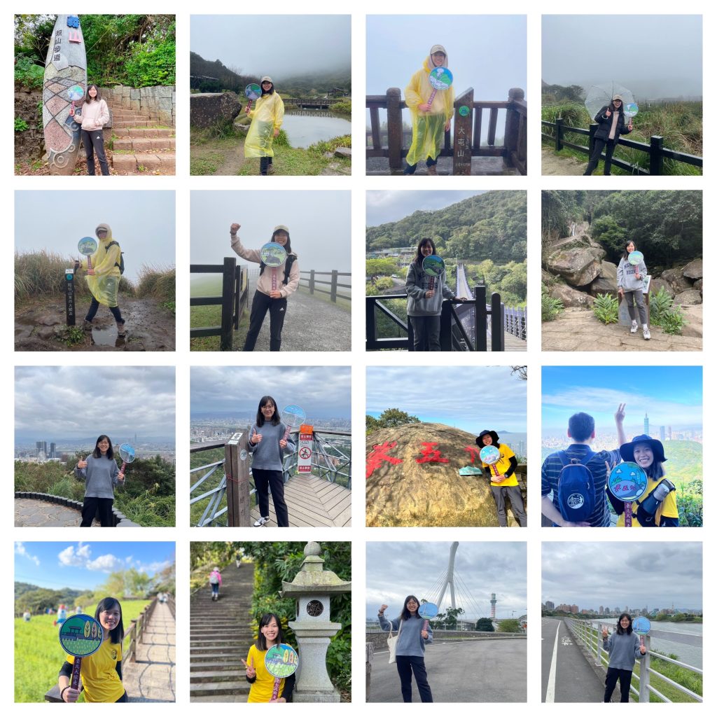
Own Signboard pictures from 2022:
Leave a Reply